
 Saut-Mathurine is the largest waterfall in Haiti; located in Camp-Perrin, Sud. The source of its stream of water comes from the Rivière de Cavaillon. |
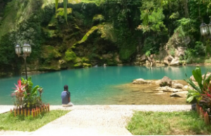
 Bassin-Bleu is a commune in the Port-de-Paix Arrondissement, in the Nord-Ouest department of Haiti. It has 33,926 inhabitants. Bassin-Bleu is a home to a waterfall/pond also called Bassin-Bleu. They are a main tourist attraction. |
|
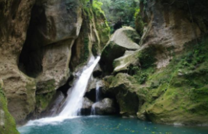
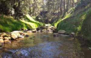
 Bassin Zim About 8 km from the city of Hinche, one of the most spectacular of falls that abounds Haiti nest in the middle of a lush tropical gem, surrounded by deep grottoes, and calciferous rocks imprinted with many indigenous artworks, from the Taino/Arawak natives who populated Ayiti, until their complete decimation with the arrival of Christopher Columbus. |
 The Pic Macaya National Park, on the southern peninsula, which is 198 kilometres (123 mi) from Port-au-Prince and 36 kilometres (22 mi) to the northwest of Les Cayes, has a designated area of 5,500 hectares (14,000 acres) that includes a ravine formation located between the mountain peaks of Pic Formon (2,219 metres (7,280 ft)) and Pic Macaya (2,347 metres (7,700 ft)). The park receives an annual average rainfall of 4,000 millimetres (160 in). The Rivere Ravine Sud rises from these mountains and flows through the park. Karst limestone formations and agricultural areas are also part of the park. There are two major types of vegetation in the park – the wet forests on limestone formations (in an elevation range of 800-1200m), and the cloud forest combined with pine forest including endemic plant species. The largest broad leaf trees are of pine some of which are 45 metres (148 ft) in height. |
 The La Visite National Park, Haiti, covers an area of 2,000 hectares (4,900 acres) (established in 1983 along the ridge of the Massive de la selle range between the hill peaks of Morne d’Enfer (elevation 1,900 metres (6,200 ft)) and Morne Kadenau (2,155 metres (7,070 ft)) with the highest mountain of Pick Cabalo lying within the park rising to an elevation 2,130 metres (6,990 ft). It is at distance of 45 kilometres (28 mi) to the south of Port-au-Prince. According to the floristic survey carried out by Walter S. Judd of the University of Florida, the plants recorded in the park are 326 species of tracheophytes that includes 262 species of angiosperms, 76 species of mosses, 19 species of liverworts. In addition, the vascular plant species reported are 112 of which 32{95ff65ad727a75d356a7865d90c70ccfa95d97b53542f9f5da12666beffa3791} are endemic species to Haiti. Reforestation programme has been undertaken since 2011 under which 300,000 seedlings were under planting in memory of the 300000 people who perished in Haiti in the earthquake of 12 January 2010. |
 |
- Haiti -
| |
|||
Information about Haiti: Haiti is a Caribbean country that shares the island of Hispaniola with the Dominican Republic to its east. Though it’s still recovering from a 2010 earthquake, many of Haiti’s landmarks dating to the early 19th century remain intact. These include Citadelle la Ferrière, a mountaintop fortress, and the nearby ruins of Sans-Souci Palace, the baroque former royal home of King Henry I. Port-au-Prince is the capital and the largest city with a population of 2,80 million (2020). Read More...
 |
 |
 |
 |
 |
 |
 |
 |
 |
 |
 |
Copyright © 2014 World Infos. All Rights Reserved. This site is developed by World-infos Terms & Conditions/Disclaimer - Privacy & Legal Advertisement: advertise@world-infos.com Contact: information@world-infos.com |
|
|||