

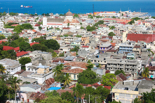
PORT-AU-PRINCE

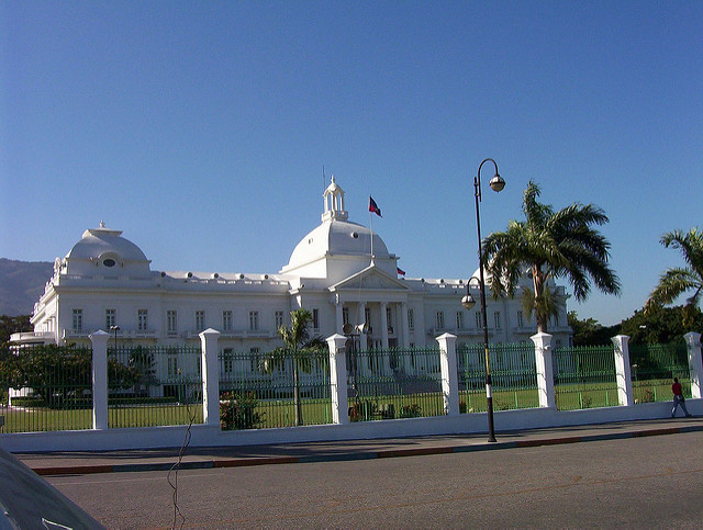
Port-au-Prince is the capital and most populous city of Haiti. The city's population was estimated at 987,310 in 2015 with the metropolitan area (aire métropolitaine) estimated at a population of 2,618,894.The metropolitan area is defined by the IHSI as including the communes of Port-au-Prince, Delmas, Cite Soleil, Tabarre, Carrefour, and Pétionville.
The city of Port-au-Prince is on the Gulf of Gonâve: the bay on which the city lies, which acts as a natural harbor, has sustained economic activity since the civilizations of the Arawaks. It was first incorporated under French colonial rule in 1749. The city's layout is similar to that of an amphitheatre; commercial districts are near the water, while residential neighborhoods are located on the hills above. Its population is difficult to ascertain due to the rapid growth of slums in the hillsides above the city; however, recent estimates place the metropolitan area's population at around 3.7 million, nearly half of the country's national population. The city was catastrophically affected[6] by a devastating earthquake in 2010, with large numbers of structures damaged or destroyed. Haiti's government estimated the death toll to be 230,000.
CARREFOUR

Carrefour is a largely residential commune in the Port-au-Prince Arrondissement, in the Ouest department of Haiti. The commune had a population of 373,916 at the 2003 Census, and was officially estimated to have grown to 511,345 inhabitants in 2015. It is mostly a bedroom community for those who work in central Port-au-Prince. The neighborhood is very poor and ill-serviced, however, as of recently, small-scale construction has gone on in the area along with street renovations.
Before the exile of Jean-Claude Duvalier, Carrefour was viewed as a Haitian tourist destination.
DELMAS 73
Population: 9,648,924 people
Area: 27,750 km2
PETIONVILLE
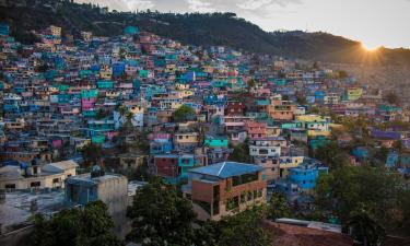
Pétionville (also written Pétion-Ville) is a commune and a suburb of Port-au-Prince, Haiti, in the hills east and separate of the city itself on the northern hills of the Massif de la Selle. Founded in 1831 by then president Jean-Pierre Boyer, it was named after Alexandre Sabès Pétion (1770–1818), the Haitian general and president later recognized as one of the country's four founding fathers. The district is primarily a residential and touristic area. It held a population of 283,052 at the 2003 Census, which was officially estimated to have reached 376,834 in 2015. Many diplomats, foreign businessmen, and a large number of wealthy citizens do business and reside in Pétionville.
Despite the distance from the capital and the general affluence of the district, the lack of administrative enforcement has led to the formation of shantytowns on the outer edges of the district, as poor locals migrate upward and have settled there in search of job opportunities.
PORT-DE-PAIX
Port-de-Paix is a commune and the capital of the Nord-Ouest department in Haïti on the Atlantic coast. It has a population of 462.000 (2015 census IHSI).
Formerly a large exporter of bananas and coffee.
Before this area was called "Xarama" during the Amerindian "Taïno" belongs to "Bainoa" the fourth of the five caciquats shared the island of Haiti where its capital was "Mariena" called by the French "Le Marien" today Plaine-du-Nord. The area around the town was given the name "Valparaíso" by Christopher Columbus after landing here in the late evening of December 6, 1492, and still contains many attractive beaches and caves locations. A ferry operates between the town and Tortuga island (La Tortue), called "Gusaeni Cahini" by the Taïnos and is situated just across the water.
The town was founded in 1665 by French filibusters, driven from Tortuga Island by the British occupiers. In 1676 the capital of the French Colony of Saint-Domingue was moved from Tortuga to Port-de-Paix, and it remained the seat of government until 1711 when the capital was moved to Cap-Français. In 1679 the town saw the first black slave revolt. The area saw great success during the 19th century but in 1802 the town was almost entirely destroyed by fire, and never attained its former status.
Port-de-Paix is also the chief town of an arrondissement of the same name. The arrondissement consists of five communes: Port-de-Paix, La Pointe des Palmistes, Bassin-Bleu, Chansolme and Tortuga.
CROIX-DES-BOUQUETS
Croix-des-Bouquets is a commune in the Ouest department of Haiti. It is located 12.9 kilometers (8.0 mi) to the northeast of Haiti's capital city, Port-au-Prince. Originally located on the shore, it was relocated inland after the 1770 Port-au-Prince earthquake. Due to this fact, it was not as badly affected in the 2010 Haiti earthquake. The city will be home to refugee tent villages of about 10,000 refugees each when the first wave of refugees begins to be resettled there.
JACMEL

Jacmel, is a commune in southern Haiti founded by the Spanish in 1504 and repopulated by the French in 1698. It is the capital of the department of Sud-Est and has an estimated population of 40,000, while the commune of Jacmel had a population of 137,966 at the 2003 Census. The town's name is derived from its indigenous Taíno name of Yaquimel. In 1925, Jacmel was dubbed as the "City of Light," becoming the first in the Caribbean to have electricity.
The city has well-preserved historical French colonial architecture that dates back from the early nineteenth century and has little changed. The town has been tentatively accepted as a World Heritage site and UNESCO reports that it has sustained damage in the 2010 Haiti earthquake.
CAP-HAÏTIEN
Cap-Haïtien often referred to as Le Cap or Au Cap, is a commune of about 190,000 people on the north coast of Haiti and capital of the Department of Nord. Previously named as Cap‑Français, Cap‑Henri and historically known as the Paris of the Antilles, displaying its wealth and sophistication through its beautiful architecture and artistic life. It was an important city during the colonial period, serving as the capital of the French Colony of Saint-Domingue from the city's formal foundation in 1711 until 1770 when the capital was moved to Port-au-Prince. After the Haitian Revolution, it became the capital of the Kingdom of Northern Haiti under King Henri Christophe until 1820.
Cap-Haïtien's long history of independent thought and its relative distance from Port-au-Prince have contribute in making it a legendary incubator of anti-establishment movements. For instance, from February 5–29, 2004, the city was taken over by militants who opposed the rule of the Haïtian president Jean-Bertrand Aristide. They eventually created enough political pressure to force him out of office and the country.
Cap-Haïtien is near the historic Haitian town of Milot, which lies 12 miles (19 km) to the southwest along a gravel road. Milot was Haiti's first capital under the self-proclaimed King Henri Christophe, who ascended to power in 1807, three years after Haiti had gained independence from France. He renamed Cap‑Français as Cap‑Henri. Milot is the site of his Sans-Souci Palace, wrecked by the 1842 earthquake. The Citadelle Laferrière, a massive stone fortress bristling with cannons, atop a nearby mountain is 5 miles (8.0 km) away. On clear days, its silhouette is visible from Cap‑Haïtien.
The small Hugo Chavez International Airport (formerly Cap-Haïtien International Airport), located on the southeast edge of the city, is served by several small domestic airlines and has been patrolled by Chilean UN troops from the "O'Higgins Base" since the 2010 earthquake. The airport is currently being expanded. Several hundred UN personnel, including nearby units from Nepal and Uruguay, are assigned to the city as part of the ongoing United Nations Stabilization Mission in Haiti (MINUSTAH).
LÉOGÂNE

Léogâne is a coastal commune in Ouest Department, Haiti. It is located in the eponymous arrondissement, the Léogâne Arrondissement. The port town is located about 29 km (18 mi) West of the Haitian capital, Port-au-Prince. Léogâne has a rich and unique culture, especially with regard to the arts, music, literature, cuisine, and architecture. It also holds importance for archaeological and ancient sites such as Fort Campan, and one of the most ancient windmills in the western hemisphere is located in Baussan Léogâne. The town was at the epicenter of the 12 January 2010 earthquake, and was catastrophically affected, with 80-90% of buildings damaged. It also had been destroyed in an earthquake in 1770. At the time of the arrival of the Europeans in 1492, Yaguana -- modern-day Léogâne -- was the capital of Jaragua, one of the five chiefdoms on the island of Hispaniola. This province was the last independent holdout during the Spanish conquest of Hispaniola until their leader Queen Anacaona was captured and killed by the Spaniards in 1503. The French secured legal access to one-third of the island from the Spanish crown by the Treaty of Ryswick in 1697 and established a city in Yaguana and renamed it Léogâne. In 1803, during the Haitian Revolution Jean-Jacques Dessalines ordered his men to burn the town to the ground to force out the last of the French colonists.
LES CAYES
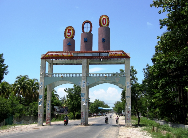
Les Cayes, often referred to as Aux Cayes (Haitian Creole: Okay), is a commune and seaport in the Les Cayes Arrondissement, in the Sud department of Haiti, with a population of 71,236. Due to its isolation from the political turmoil of the capital, Port-au-Prince, it is one of Haiti's major ports, with export trade concentrating on mostly coffee and sugarcane. As the world's largest supplier of vetiver, it exports 250 tons annually of this ingredient of perfume and fragrance manufacturing. Minor exports include bananas and timber.